Hersham is a proud community. Let us all take the opportunity to keep it that way, for the benefit of everybody. It needs all of us to be active, vocal and supportive. With this support we will create a better future for everyone in our village.

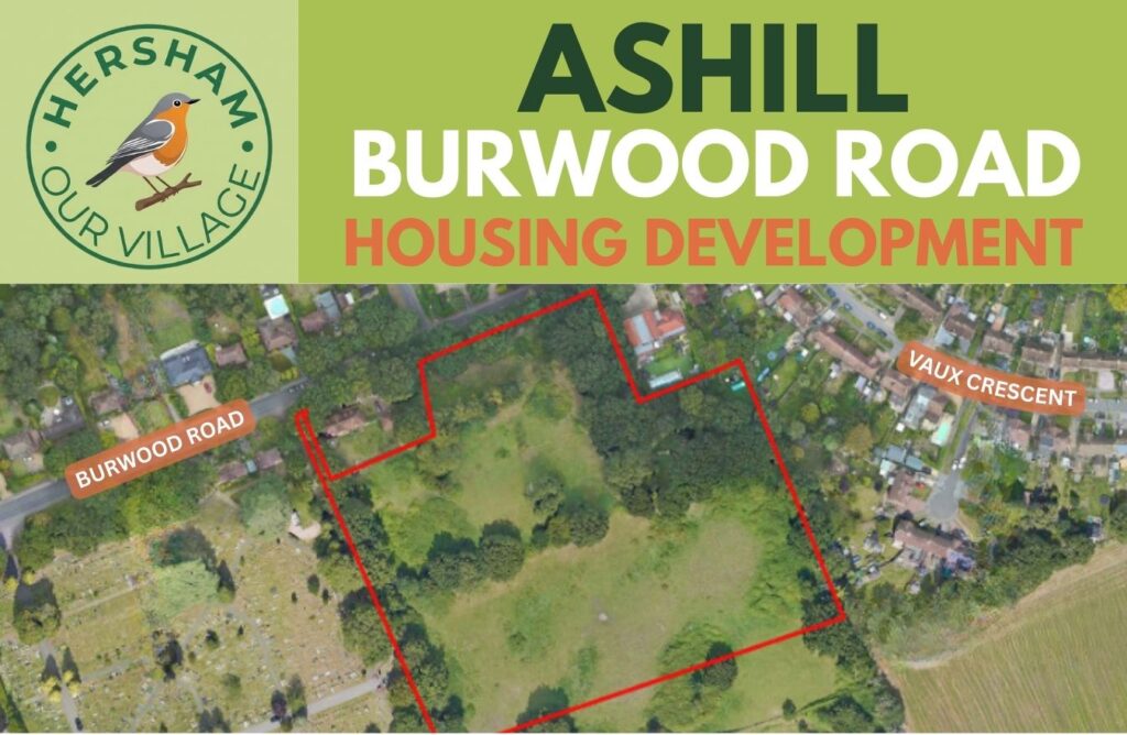
Objection to Planning Application 2026/0447
Proposed footway along the south of Burwood Road
This is an objection from Positively Hersham, a sub-committee of Hersham Community Group, against Planning Application 2026/0447 regarding land to the south of 131 to 147 Burwood Road, Hersham. This objection is one of several objections sent under separate cover.
This particular objection relates to the proposed footway along the south of Burwood Road.
It is appreciated that many of the issues raised in this objection are under consideration by Surrey County Council Highways, and we have been advised to raise our concerns with Elmbridge Borough Council’s Planning Department.
The applicants have acknowledged that pedestrian access to and from the site requires substantial works on land that is currently soft verge, bordering a deep open ditch which serves as a main surface water sewer. The full extent of the work is referenced in the application plan Site Access and Footway Connection, number BWR-RGP-XX-XX-DR-T-002.
We have major concerns about the proposed public highway works:
- The plan is inaccurate.
- The proposals do not comply with modern standards or guidelines.
- The proposals present a risk of serious injury and a danger to life, particularly to children, elderly people and disabled people.
Inaccurate plan
Whilst it is acknowledged that the Site Access plan is a proposal, any proposal must consider the topography of the land in question. In this case, there is no proposal to alter the course of the ditch in any way. Furthermore, consultees to the application have also insisted that culverting must be kept to a minimum.
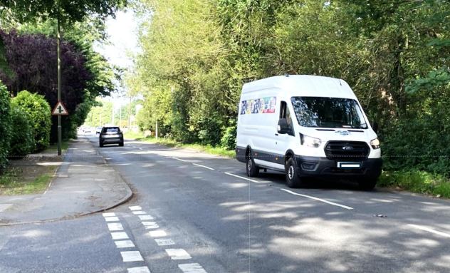
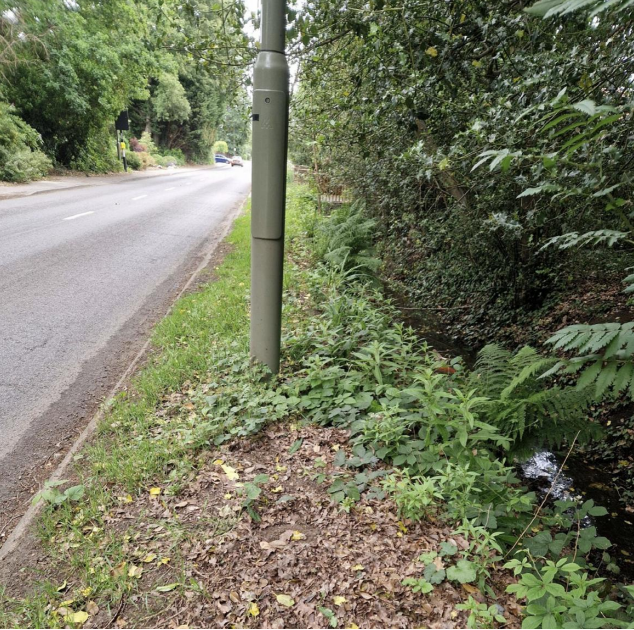
It is a fact that the distance from the road kerb to the edge of the ditch varies between 1.3m and 1.5m across very soft verge (see Photo 3 below). In order to achieve a pedestrian walkway of 1.5m, as suggested by the applicants, including a retaining wall to support the path, it would be necessary to undertake very substantial solid engineering works within a large part of the ditch. This would be to the permanent detriment of the prime purpose of the ditch itself. The ditch forms part of a Surrey County Council-mapped historic wetspot.
The boundaries shown on the plans are inaccurate. The highway boundary is shown as being in the middle of the ditch, but we believe that the boundary is the kerb on Burwood Road. The applicant’s boundary is also shown as being in the middle of the ditch. It is not, as evidenced by the Land Registry. We believe the boundary of the applicant-owned land is approximately 7m from the road kerb. It would seem that the applicant is relying on consent from unknown third-party ownership, but it is not possible for a planning permission to place conditions on unknown third parties.
Non-compliance with regulations and guidelines
There are numerous publications concerning the width of new pedestrian footways, particularly in relation to new developments such as this one, including:
- Highways England and Department for Transport design manuals
- Department for Transport’s Inclusive Mobility
- Active Travel England guidance
- Elmbridge Borough Council Design Code, including paragraph 4.1.1
The stated minimum width in all these references is never less than 2.0m.
There are references to absolute minimum widths, referring to cases where there is an existing physical constraint, and desirable minimum widths where conditions for absolute minimum widths do not apply. The Highways England Design Manual states an absolute minimum width of 2.0m and a desirable minimum width of 2.6m. The proposed width is 1.5m. However, this assumes there are no issues regarding separation from the road itself or any other constraints, such as the immediate dangerous slope forming the ditch.
It is interesting to note that the footways within the development itself are shown as 2.0m. These footways are not affected by the fast road and the open surface water sewer. Furthermore, the Design Code provides that links should have a continuous footway of at least 2m of unobstructed width. This is clear evidence that, with the presence of the open surface water sewer and fast traffic, the proposed footway on Burwood Road is inappropriate in both design and dimension.
In addition, because of the street furniture required for a pedestrian crossing and other lighting, the applicant’s plan shows that the width reduces to just 1.0m. With this in mind, it is noted that the applicants have chosen to provide a zebra crossing rather than a controlled crossing, which will require even more street furniture and create further obstruction to the free passage of pedestrians (see Cross-section C below).
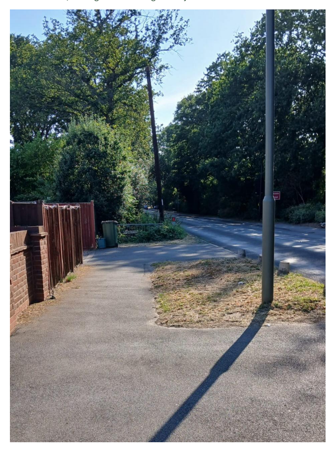
It is also worth noting the dimensions of the other existing footways in the immediate vicinity: the footway opposite, on the north side of Burwood Road (see Photo 1), and the point at which the new footway is proposed to join the existing footway by Vaux Crescent, on the south side of Burwood Road (see Photo 2).
The north footway is on average 1.9m wide and has a level grass verge immediately adjoining it averaging 1.5m, giving an average safe, usable width of 3.4m. The existing footway at the point where it would join the proposed new footway is more than 2.0m wide and has a safe, level verge exceeding 2.0m, giving a usable width of more than 4.0m.
This is an application for a new development on previously undeveloped land. At the very least, it should comply with modern standards. It does not. The proposed new footway of 1.5m – even if it were possible to build – would have an immediate, unprotected drop into a deep open ditch.
Serious risk of injury and danger to life
Hersham Community Group is a well-known and seriously minded residents’ association which deals in facts, not speculation. We have immense concern about the potential consequences of building this footway as proposed. The facts are there for all to see. The details below are drawn to scale and are taken from actual measurements on site and plans provided by the applicants.
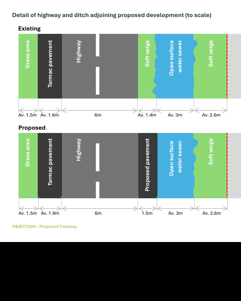
Detail of the highway and ditch adjoining the proposed development, showing the existing and proposed layouts to scale.
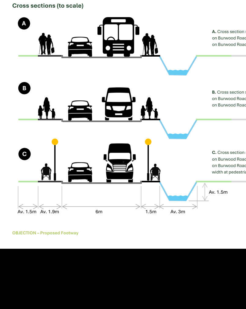
Cross-section A
Difference between the existing footway on Burwood Road North and the proposed unacceptable footway on Burwood Road South, shown with two adults.
Cross-section B
Difference between the existing footway on Burwood Road North and the proposed unacceptable footway on Burwood Road South, shown with a mother and two children.
Cross-section C
Difference between the existing footway on Burwood Road North and the proposed unacceptable footway on Burwood Road South, showing wheelchair use at the reduced width by the pedestrian crossing.
Conclusions
The proposed highway and pedestrian works are:
- Based on inaccurate plans and assumptions.
- Non-compliant with good practice and professional recommendations.
- A serious risk of accident, particularly to children, elderly people and wheelchair users, due to the proximity of vehicles and the open surface water sewer.
The application should be refused.





Hersham is a proud community. Let us all take the opportunity to keep it that way, for the benefit of everybody. It needs all of us to be active, vocal and supportive. With this support we will create a better future for everyone in our village.
Our Newsletter 9 June 2025 made the factual observation that the fabric of The Centre is in visible decline and that 40% of the shop units have become vacant since purchase by the developers.